 Rechargeable lithium-ion batteries have become indispensable for consumer electronics and for powering electric cars. However, there are currently no available tools or methods to detect lithium in actual geological context by remote sensing and its feasibility is poorly understood.
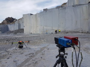
As a result of technological advances, the use of hyperspectral cameras with drones is now possible to map the mineralogy of rocks. This recent tool introduces new possibilities to easily map future exploitable mineral resources and possibly enhance associated resources and reserves.
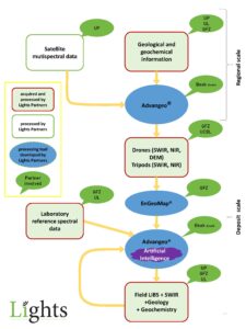
For this end, we are introducing the Lightweight Integrated Ground and Airborne Hyperspectral Topological Solution (LIGHTS) that comprises cutting edge drone, camera and software technology. It will be firstly applied to European Li-deposits.For the first time in the world, the proposed technology enables the mapping of lithium such that for a given area, the likelihood of the element is clearly displayed for each geographic point.
The system requires a minimum amount of expertise on remote sensing or drone technologies, making it an ideal tool for field geologists, enabling them to focus on geology instead of technology.
 The LIGHTS project brings together world-leading industrial and research organizations to develop new methods and tools for drone-based lithium exploration. The general objectives of the project are:
1) To develop a software for easy and fast detection of lithium-host minerals combining drone-borne remote sensing data and field observations
2) To understand how pegmatitic Li-deposits are formed. This is critical to establish how remote sensing and field observations can be used to unveil lithium deposits.
We foresee that the tools developed during the project have the potential to boost mineral exploration industry in general, resulting in increasing exploration activities in Europe and beyond, to a variety of different ore deposits and geological environments around the globe.
